
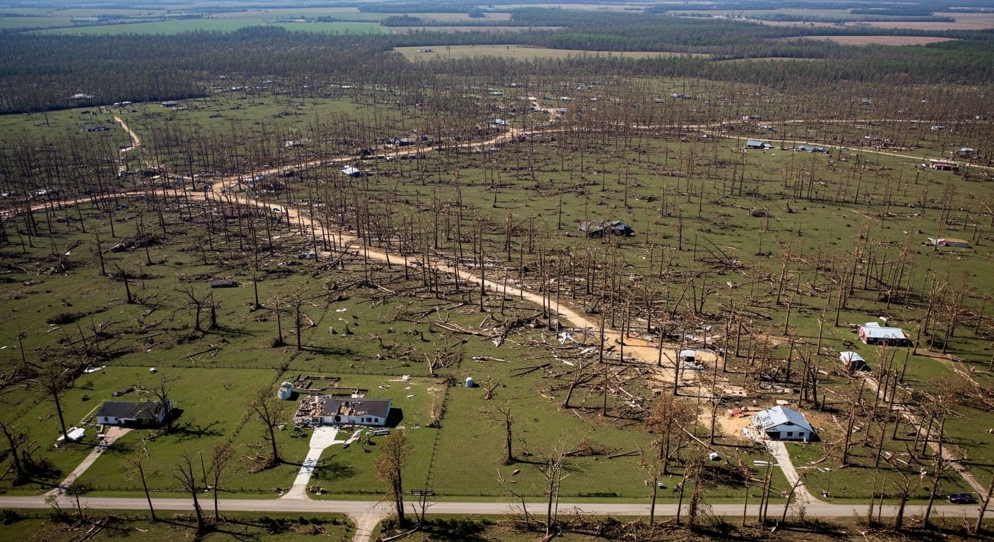
A powerful tornado, the strongest of several that touched down in southern Mississippi in early May 2026, carved a visible path of damaged vegetation across five counties, satellite imagery shows. The supercell storm on May 6, 2026, produced wind speeds up to 137 miles per hour, causing EF-3 damage in several areas, according to the Enhanced Fujita Scale.
NASA's Landsat 8 satellite captured the destruction on May 12. Winds snapped, uprooted, and stripped bark from trees, creating a brownish track across the landscape. This area, south of Brookhaven in Lincoln County, suffered EF-3 damage. National Weather Service (NWS) assessments noted extensive tree damage, a home with collapsed exterior walls, and a “devastated” mobile home park.
Long Track Tornado
The tornado’s path extended far beyond the satellite image.
It originated in St. Catherine Creek National Wildlife Refuge, near the Mississippi River, approximately 60 miles west-southwest of Brookhaven. Traveling nearly 82 miles in just over two hours, it ranks among Mississippi's longest recorded tornadoes. NWS surveys confirmed heavy tree damage along its entire route, including instances of EF-2 structural damage and bent or collapsed transmission towers.
Seven tornadoes struck Mississippi on the evening of May 6, NWS preliminary data indicated as of May 20. The Mississippi Emergency Management Agency reported damage to more than 400 homes and dozens of businesses and farm buildings statewide, with the majority concentrated in Lincoln County.
Southeastern Tornado Activity
Seven tornadoes struck Mississippi on the evening of May 6, NWS preliminary data indicated as of May 20.
While not part of the traditional Tornado Alley, the U.S. Gulf Coast and other southeastern states are prone to tornadoes, with high frequencies in spring and late autumn. Historically, Mississippi averages more than seven tornadoes in April and just over three in May. Recent analyses suggest a decrease in tornado frequency in the Great Plains and an increase in the Southeast over several decades.


COMMENTS